


Bella-Tola
The Bella-Tola is THE summit in St-Luc, not the only one, but perhaps the most beautiful. It's a long way, easy, from top station of our Funicular, at 2'180 m altitude. Then you'll walk across a little...
The Bella-Tola is THE summit in St-Luc, not the only one, but perhaps the most beautiful.
It's a long way, easy, from top station of our Funicular, at 2'180 m altitude. Then you'll walk across a little single track, getting to Cabane Bella-Tola, at 2'345 m.
The track gets larger, and you'll travel across the skiing pistes (closed in summer), to join the Bella-Tola lake - it's a little lake, very kind.
After that, the difficult part begins (after about 1,5 hours): the track goes up to the summit, on a steep slope. A normal person in normal fisical conditions can walk up to the summit.
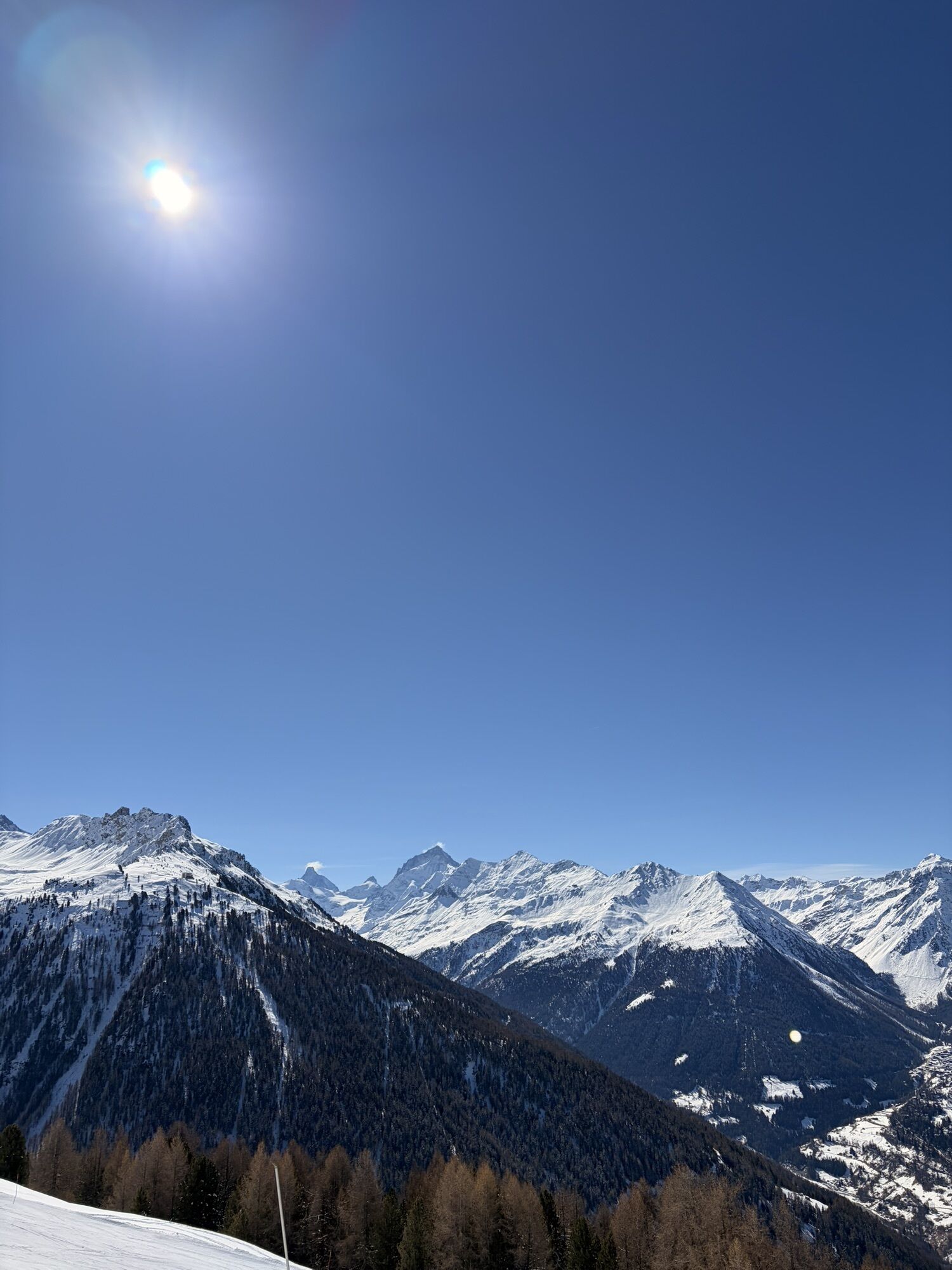
The summit: a nice place to be: no vertigo, a nice little glacier behind, and a large, very large view on the Alps. Examples: The Mischable Gruppe (to Saas-Fee), the Matterhorn, the Mont-Blanc, The Bietschhorn (to Aletsch), the Dents du Midi (to Champéry), and a lot of them again you will see from this summit. SPLENDID.
Extra: there is a revolving light on the summit (yes, just like on the coasts of this Earth for the boats !!). Something to see.


If you don't want to train or to walk to o much for your fisicla conditions, we have the solution: just walk till the little lake, and go back to Cabane Bella-Tola. It's a tremendous place to hav good times !
Not necessary - good indications
With the Funicular, at 2'180 m, you'll win 2 hours on your hiking time..
Beliebte Touren in der Nähe
- 4,0
Grand Bisse de Lens
leichtWanderung 8,73 km Tour du Lac de Moiry
mittelWanderung 13,4 km- 4,0
Wolfstritt
Wanderung 7,02 km - 5,0
Bisse du Tsittoret mit der Familie
leichtWanderung 7,14 km - 5,0
777 (Flaschen- Torrentalp- Rinderhütte)
Wanderung 3,50 km Kinderwanderweg MoosAlbi uns seine Waldtiere
leichtWanderung 3,50 kmTorrentalp - Rinderhütte
Wanderung 4 km- 4,0
Klettersteig Moiry
schwerKlettersteig 2,93 km - 5,0
Zinal - Cabane du Petit Mountet
mittelWanderung 12,0 km Moosalp – Augstbordhorn
schwerWanderung 5,97 km
Wandern & Tracking


Verpasse keine Angebote und Inspirationen für deinen nächsten Urlaub
Deine E-Mail-Adresse wurde in den Verteiler eingetragen.