

Mit App navigieren
Hol diese Tour auf dein Handy
Karte
Ammerlandroute
schwer
Radfahren
164,30 km
QR-Code scannen und Navigation in der bergfex App beginnen
QR Code
Wandern & Tracking
Wandern & Tracking
Download für iOS
Download für Android

Ammerlandroute

Karte
Distanz
164,30 km
Dauer
09:07 h
Aufstieg
534 hm
Seehöhe
- m
Track-Download
Karte
Ammerlandroute
schwer
Radfahren
164,30 km

If one were to bring the experience qualities of the Ammerland route down to a common denominator, the slogan would be "Cycling fun and blooming!" apt. This expression was not designed by resourceful marketing...

Beschreibung

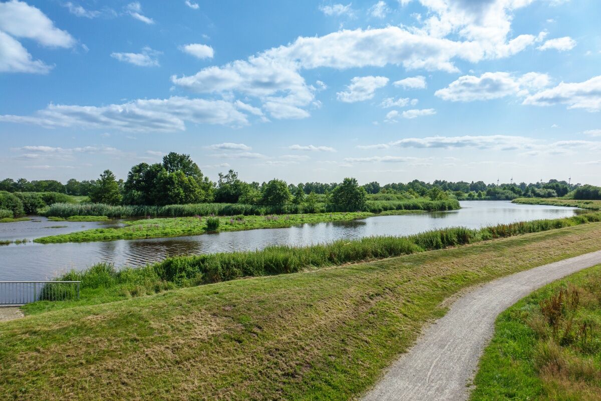
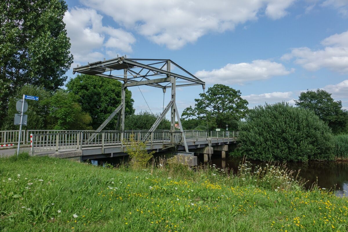
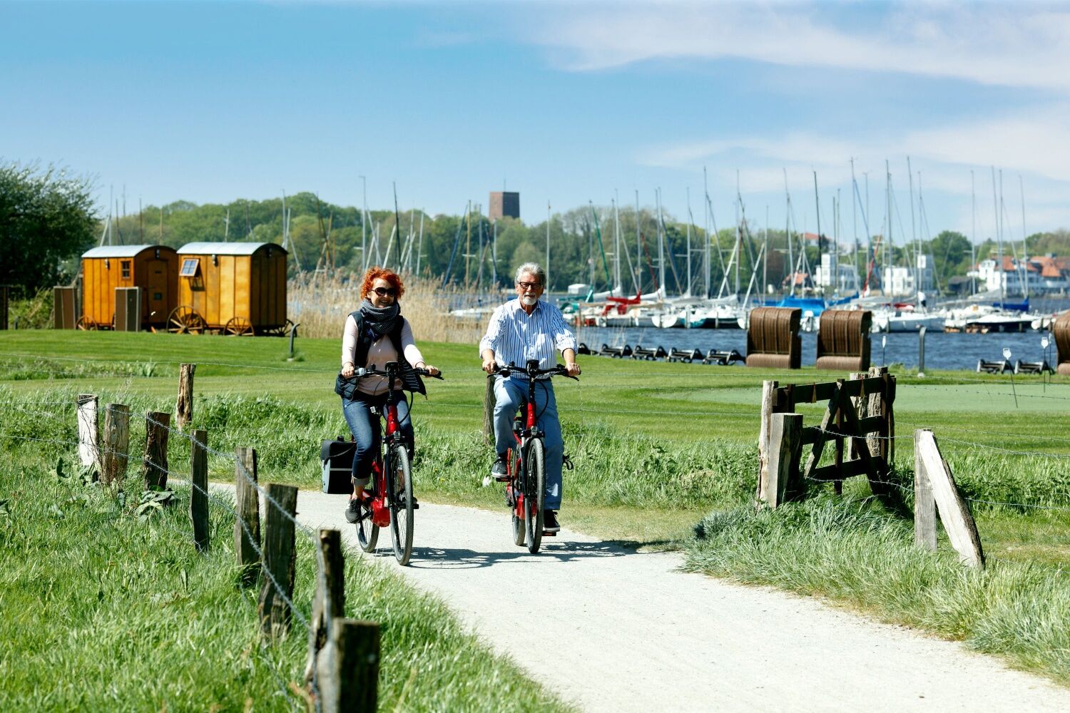
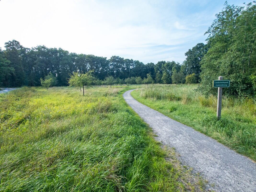
If one were to bring the experience qualities of the Ammerland route down to a common denominator, the slogan would be "Cycling fun and blooming!" apt. This expression was not designed by resourceful marketing strategists, but by the cycling guests, who expressed their most intense impressions of the enchanting landscape they traversed in two words. On the Ammerland route, you can experience the region's diverse landscape forms very naturally and up close. In the northwest you cycle through a unique fen landscape, which is characterized by white bascule bridges and elongated canals. In the east, cyclists can take the transition from the Geest to the marshland, the so-called Geestrandabfall with a gradient of almost 20 meters under the wheels. In the geographical center of the park landscape, cyclists can expect the Zwischenahner Meer, the third largest inland lake in Lower Saxony, also known as the "Pearl of the Ammerland". Numerous larger forest areas protect cyclists on the route from the often strong North Sea wind from the northwest. Large moor areas invite you to go on discovery tours. Everywhere there are surprising and picturesque looks that never let you get bored.


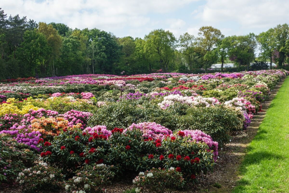
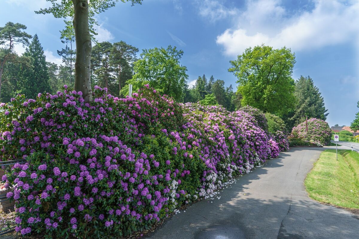
The Ammerland park landscape is typical for the area and particularly attractive due to its special design, which is characterized by the plantings of the 180 Ammerland tree nurseries. The many cultivated plants underline the charm of the enchanting nature and round off the graceful impression of the surroundings harmoniously. So the Ammerland presents itself in spring in a bright green and extremely colorful; a rush of colors caused by the thousands of blooming rhododendrons and azaleas that have found a new home here and are sold all over the world. But other seasons also promise intense color experiences that cannot be found anywhere else in this quality.
Wegverlauf
Ihorst
(13 m)
Dorf
0,0 km
Pauluskirche
(7 m)
Andachtsstätte
36,5 km
Yunus Emre Moschee
(10 m)
Andachtsstätte
66,5 km
Rastede
(10 m)
Stadt
89,3 km
Rastede
(10 m)
Stadt
98,1 km
St.-Petri-Kirche
(13 m)
Andachtsstätte
144,5 km
Neuapostolische Kirche Westerstede
(11 m)
Andachtsstätte
155,4 km
Wegverlauf
Karte
Ammerlandroute
schwer
Radfahren
164,30 km
Ihorst
(13 m)
Dorf
0,0 km
Kleine Pause bei Moritz
(7 m)
Restaurant
1,7 km
Augustfehn III
(5 m)
Dorf
7,3 km
Lengenermoor
(4 m)
Dorf
9,3 km
Gnieser-Kreuzung
(3 m)
Flur/Gelände
9,3 km
Augustfehn
(6 m)
Dorf
9,8 km
Vreschen-Bokel
(5 m)
Dorf
13,5 km
Tange
(4 m)
Dorf
19,4 km
Barßel
(4 m)
Dorf
20,5 km
Nordloh
(4 m)
Dorf
22,1 km
Landgasthof Hengstforder Mühle
(2 m)
Restaurant
28,2 km
Restaurant Saloniki
(6 m)
Restaurant
29,5 km
Brasserie am Markt
(5 m)
Restaurant
29,7 km
St.-Nikolai-Kirche Apen
(5 m)
Andachtsstätte
29,8 km
Apen
(4 m)
Dorf
30,0 km
Apermarsch
(6 m)
Siedlung
31,5 km
Ocholt
(5 m)
Dorf
36,0 km
Pauluskirche
(7 m)
Andachtsstätte
36,5 km
Howiek
(6 m)
Dorf
37,4 km
Voßbarg
(4 m)
Dorf
38,8 km
Wittenberge
(4 m)
Siedlung
44,8 km
Westerscheps
(6 m)
Dorf
50,0 km
Schützenhof Scheps
(8 m)
Restaurant
51,4 km
Osterscheps
(8 m)
Dorf
51,6 km
Edewecht
(10 m)
Stadt
56,1 km
Portsloge
(23 m)
Dorf
59,8 km
Specken
(11 m)
Dorf
64,5 km
Bad Zwischenahn
(10 m)
Bahnhof
66,1 km
Yunus Emre Moschee
(10 m)
Andachtsstätte
66,5 km
Bad Zwischenahn
(7 m)
Stadt
68,1 km
Apicius
(11 m)
Restaurant
70,6 km
Eiden
(11 m)
Siedlung
70,6 km
Dreibergen
(10 m)
Dorf
74,0 km
Meyerhausen
(9 m)
Siedlung
74,7 km
Kreyenkamp
(14 m)
Siedlung
76,4 km
Gristeder Hof to Horn
(14 m)
Restaurant
76,9 km
Gristede
(14 m)
Dorf
77,0 km
Gesellschaftshaus Martens
(19 m)
Restaurant
84,3 km
Bokel
(19 m)
Dorf
85,0 km
Bokelerburg
(16 m)
Dorf
87,0 km
Leuchtenburg
(20 m)
Dorf
87,3 km
Restaurant Panda
(20 m)
Restaurant
88,1 km
Kleinenfelde
(19 m)
Stadtteil
88,3 km
Rastede
(10 m)
Stadt
89,3 km
Schloßpark
(31 m)
Stadtteil
90,5 km
Loy
(9 m)
Dorf
93,7 km
Ammerländer Landschaftsfenster Geestrand "Turm eines Malers"
(17 m)
Aussichtspunkt
97,8 km
Rastede
(10 m)
Stadt
98,1 km
Hankhausermoor
(7 m)
Siedlung
100,6 km
Lange Wisch
(-1 m)
Flur/Gelände
101,4 km
Delfshausen
Dorf
103,5 km
Dorfkrug Delfshausen
(2 m)
Restaurant
103,6 km
Südbäke
(3 m)
Dorf
105,2 km
Lehmdermoor
(7 m)
Siedlung
106,7 km
Hahn-Lehmden
(16 m)
Dorf
110,8 km
Pizzeria Sorrente
(11 m)
Restaurant
110,9 km
Kijan Grill
(11 m)
Restaurant
111,1 km
Nethenerfeld
(13 m)
Dorf
115,3 km
Kortebrügge
(20 m)
Siedlung
117,8 km
Wemkendorf
(18 m)
Siedlung
120,9 km
Moor-Placken
(14 m)
Flur/Gelände
122,5 km
Wiefelstede
(18 m)
Stadt
123,6 km
Hollen
(21 m)
Siedlung
126,6 km
Dringenburg
(19 m)
Dorf
129,7 km
Garnholterdamm
(17 m)
Siedlung
132,6 km
Linswege
(11 m)
Dorf
139,9 km
Waldhotel am Wittenheimer Forst
(10 m)
Restaurant
142,8 km
St.-Petri-Kirche
(13 m)
Andachtsstätte
144,5 km
Kirchenbüro
(11 m)
Andachtsstätte
144,5 km
Westerstede
(6 m)
Stadt
144,6 km
Landschaftsfenster Rhododendron
(16 m)
Aussichtspunkt
146,6 km
Gießelhorst
(11 m)
Dorf
148,0 km
Fikensolterfeld
(15 m)
Siedlung
151,0 km
Neuapostolische Kirche Westerstede
(11 m)
Andachtsstätte
155,4 km
Westerstede
(6 m)
Stadt
155,5 km
Halstrup
(11 m)
Stadtteil
156,8 km
Hollwege
(6 m)
Dorf
159,1 km
Hollwegerfeld
(14 m)
Dorf
160,7 km
Ihorst
(13 m)
Dorf
164,0 km
Toureninfo

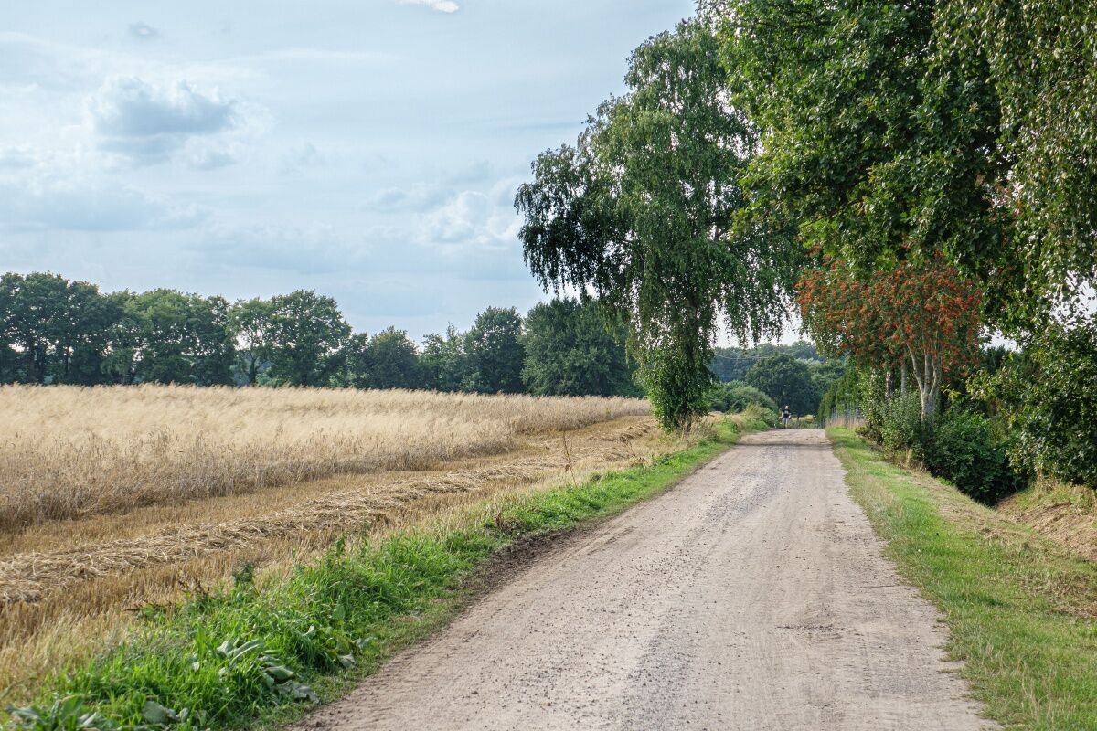
Since 1994, the 164 km long Ammerland route has made the most beautiful highlights of the Ammerland park landscape accessible to cyclists. It leads over low-traffic and incline-free paths that enable relaxing cycling in the great outdoors.

Technik
k.A.
Kondition
5 / 6
Landschaft
6 / 6
Erlebnis
k.A.
Autor
Bereitgestellt von Ammerland Touristik
Tour teilen
Karte
Ammerlandroute
schwer
Radfahren
164,30 km
Fehler
Ein Fehler ist aufgetreten. Bitte versuche es erneut.
Weginformationen
Wegverlauf

Uniform and good signage accompanies you along the entire Ammerland route.

Kartenmaterial
KV Plan Ammerland, scale 1: 60,000, price € 7.95 to be ordered from:

Ammerland-Touristik 
Ammerlandallee 12
26655 Westerstede
Tel.: 04488 56 30 00
atis@ammerland.de 
www.ammerland-touristik.de

Ausrüstung

No special equipment is required.

Sicherheitshinweise

The Ammerland route can be carried out without any danger. Flat landscapes and well-developed cycle paths make it easy to ride.

Anreiseinformationen
Anreise
A28 / A29 / A31

You arrive by car along the A1 and A 29 autobahns to Oldenburg and from Oldenburg on along the A 28 towards Emden / Leer to Westerstede.

Öffentliche Verkehrsmittel
You can travel comfortably by train at the following train stations in Ammerland and the region.


Railway stations: Leer, Augustfehn, Westerstede-Ocholt, Bad Zwischenahn, Oldenburg, Rastede


You can easily reach the other places and districts by bus.

Parken

You will find public and free parking spaces at many start and finish points.

Zusatzinfos & Tipps
Tipps

In May, you can visit the largest rhododendron park in Germany. In the village of Linswege on the stage from Westerstede to Wiefelstede there is the 70 hectare park, which is also considered by experts to be one of the most beautiful in Europe. Rhododendron Park Hobbie, Alpenrosenstrasse 7, Westerstede / Petersfeld, Tel. 04488/2294

Noch keine Bewertungen
Bewertung schreiben

Bewertungen helfen anderen Usern bei der Auswahl ihres nächsten Abenteuers. Bewerte bitte nur die Tour, nicht das Wetter oder deine Jause.

Wähle einen der Sterne um die Tour zu bewerten
Schlechte Tour
Schwache Tour
Mittelmäßige Tour
Gute Tour
Ausgezeichnete Tour
bergfex logoHol dir den Einblick Immer live vor Ort mit über 9.500 Webcams. In der Touren App von bergfex siehst du als Pro-User jetzt zu vielen Touren die passenden Webcams. So kannst du dir direkt die aktuellen Bedingungen ansehen.
Wandern & Tracking

Wandern & Tracking

für iOS herunterladenfür Android herunterladen
Wandern & Tracking
Über 550.000 Tourenvorschläge, detailliertes Kartenmaterial und ein intuitiver Routenplaner machen die App zum Must-have für alle Naturbegeisterten.
bergfex