


Pohjantikka trail, Tammela
The Pohjantikka tour in Liesjärvi National Park is a hiking trail that starts in Korteniemi and follows the shore of Lake Liesjärvi. Liesjärvi National Park is part of the Häme Lake Upland, whose rugged...
The Pohjantikka tour in Liesjärvi National Park is a hiking trail that starts in Korteniemi and follows the shore of Lake Liesjärvi. Liesjärvi National Park is part of the Häme Lake Upland, whose rugged wild forests are dominated by forested lakeshores.
Trail description
The trail proceeds through varying terrain, first following the Hämeen Ilvesreitti trail. The trail features spruce forests, primeval forests and a bog. The first part of the trail is a forest track. After three kilometres, the terrain becomes wetter and the trail has duckboards. In Pitkäkärki there is a small meadow with a barn and beautiful views over Lake Liesjärvi. The rest of the trail proceeds next to the fields.
Good to know
You can easily leave the trail for a bit to explore the Ahonnokka nature trail, where you can see old virgin forest. The nature trail is 1½ km long and features information boards about the animals of the forest. The trail network is part of the Hämeen Ilvesreitti hiking trail network, which includes over 200 km of trails.
Ja
Ja
Difficulty level
The first part of the trail along the forest track has some rocky patches and tree roots. The trail features duckboards. After the duckboards, the trail continues along a fairly easy trail. The trail features some changes in elevation.
Duration
About 2 h
Trail markings
The trail is marked with with blue diamond shapes made of wood
Suitability
The varying terrain presents some challenges for hikers
TO START THE TRAIL
Korteniementie 269
31380 Tammela
N60 39.207 E23 53.875
Kulkuyhteydet
Pohjantikan kierrokselle pääsee Korteniemen (Korteniementie 242) pysäköintialueelta. Liesjärven kansallispuisto sijaitsee valtatie 2:n (Helsinki - Pori) varrella, Tammelan, Someron ja Karkkilan alueella, noin 95 km Helsingistä ja 22 km Forssasta. Valtatie 2:lla liikennöi useita pikavuoroja päivittäin. Lähimmät pysäkit ovat Eerikkilän tienhaara, josta matkaa Hämeen luontokeskukselle on 1,5 km tai Loukun tienhaara, josta 6 km:n mittaiset metsätiet johtavat kansallispuistoon.
Sights
Along the route you can explore the Korteniemi Heritage Farm, which has farm animals in the summer and farms old traditionally Finnish crops using traditional methods.
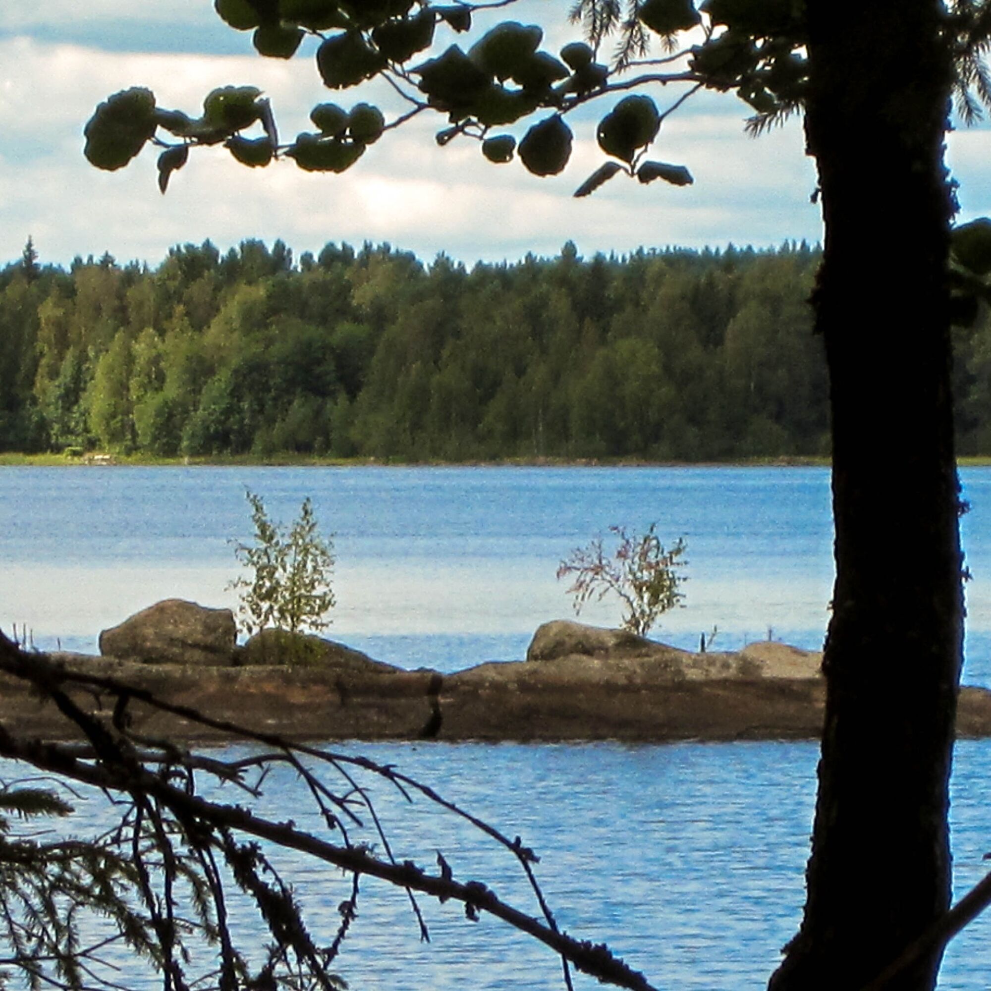
Liesjärvi National Park
Beautiful views of Lake Liesjärvi
Photo gallery of Pohjantikka tour
Beliebte Touren in der Nähe
Kivijärvi-Rundweg 27 km (Hämeen Ilvesreitti)
schwerWanderung 28,4 kmSaare Kansanpuisto, Hämeen Ilvesreitti 3,5 km
Wanderung 3,45 kmRuostejärvi - Saari Hämeen Ilvesreitti 14,3 km
schwerWanderung 14,3 kmHämeen Ilvesreitti Liesjärvi 19,6 km
mittelMountainbike 19,4 kmHämeen Ilvesreitti Iso-Melkutin-Kaitajärvi 10,2 km
mittelMountainbike 9,80 kmHämeen Ilvesreitti Kaitajärvi - Iso-Melkutin 6 km
Wanderung 2,96 kmKivisammaljärvi-Rundweg 2,6 km
leichtWanderung 2,53 kmHyypiö-Pfad, Tammela
mittelWanderung 5,89 kmSaaren kansanpuiston harjureitti 2,5km
Wanderung 2,51 kmVaellusreitti Liesjärvi 16,1km
schwerWanderung 16,7 km
Wandern & Tracking


Verpasse keine Angebote und Inspirationen für deinen nächsten Urlaub
Deine E-Mail-Adresse wurde in den Verteiler eingetragen.