


Donaufelsenläufe - Wilde Täler - fürstliche Höhen
On this sporty tour through the picturesque Schmeien and the primeval Uschental valleys, there is a lot of nature, striking and unique rock formations and beautiful opportunities to rest. The ascent to...
On this sporty tour through the picturesque Schmeien and the primeval Uschental valleys, there is a lot of nature, striking and unique rock formations and beautiful opportunities to rest. The ascent to the Fürstenhöhe is "princely" rewarded with a Säntis view.
We start our tour at the Fürstenhöhe and hike in a westerly direction. At the parking lot we keep to the right and follow the gravel path now steadily downhill into the forest until we come to the next larger intersection. There we leave the gravel path and hike straight down the grassy path until we reach the Kesseltal. There we keep to the left for a short while, and immediately afterwards we branch off again into a meadow path in a northerly direction. Following the valley floor of the Kesseltal steadily upwards, we reach another forest road after about 700 m, but we leave it on the right and branch off on the narrow path below the forest road. After a short while we step out of the forest and hike on the dirt road parallel to the slope across the fields until we can only continue left or right. We decide on the former option, which leads us to the cozily situated resting place "Hinter dem Sonnacker" under towering trees. Here we take a break or hike directly further down into the forest.
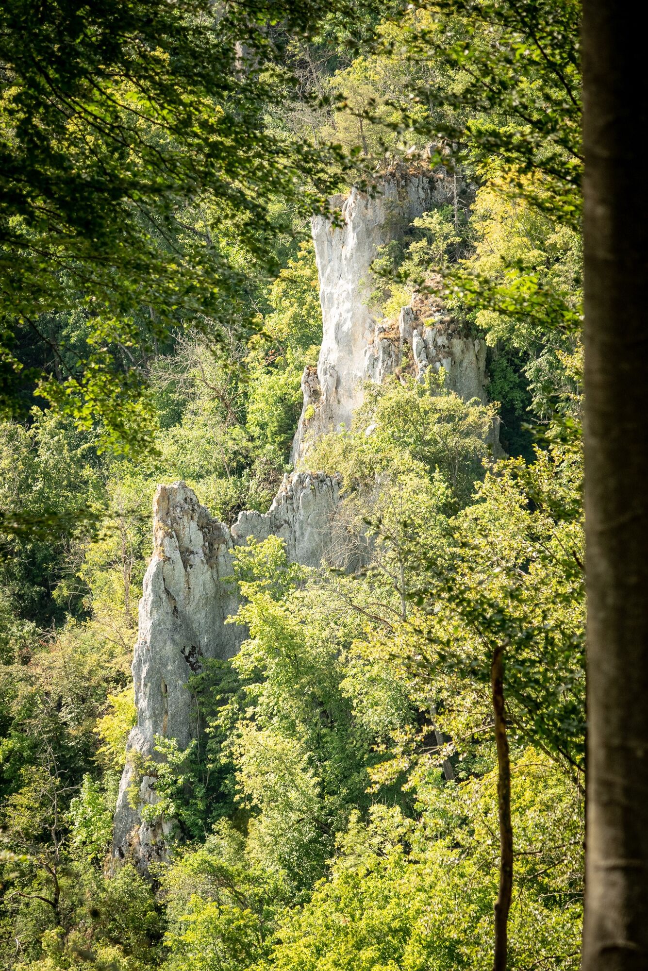
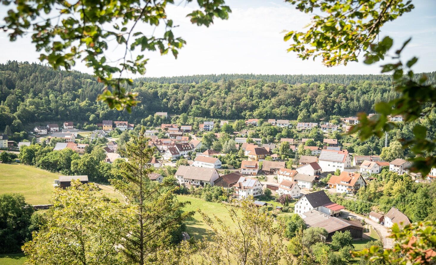
After some time the forest road changes again into a forest path, which we follow steadily. We leave the viewpoint Irrleberg behind us and continue hiking until the path changes again into a trail, which leads us to the next largest viewpoint at Zupferfelsen. After another 600 m we reach the first possible turnoff to Storzingen, but we leave it on the right until we reach the viewpoint "Langer Felsen". Here we enjoy the beautiful view of the village of Storzingen and allow ourselves a few minutes in silence on the observation bench. We continue on a narrow natural path downhill until we meet a paved gravel path again. We turn right and walk to the Wolferget parking lot, the second turnoff to Storzingen. But we keep left and now enjoy the path that leads us through the lovely Schmeiental. We reach the "Schmeiental" rest and parking area, where there is an opportunity for a barbecue picnic. On warm summer days you can also cool your feet in the water of the Schmeie at the new wooden bridge opposite.
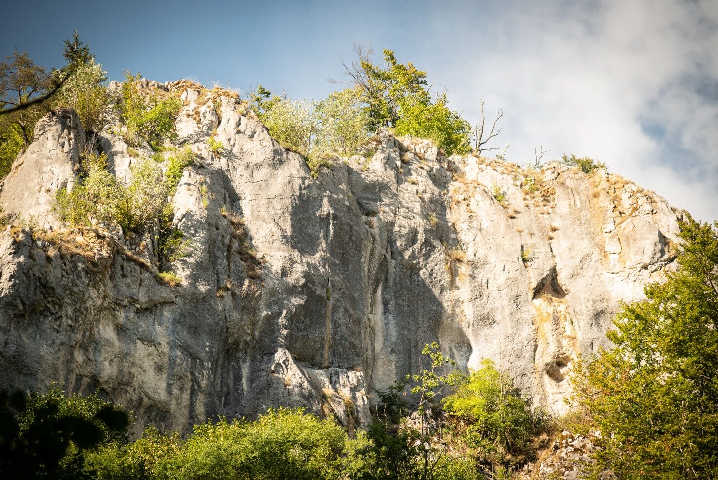
Our way leads us further along the Schmeie to the east. At the next crossing we keep straight on the gravel path, which leads us in a gradual ascent further and further up into the wild and romantic Uschental. There we pass the Rappenfelsen on the left, a large limestone formation. We continue to follow the path until a signpost indicates the further ascent along a narrow path through a mixed forest grove. At first on a flat ascent, then later on a steep ascent, we climb here on a natural path almost 100 meters in altitude at a stretch, but on hot summer days the towering trees of the mixed forest offer us enough shade.
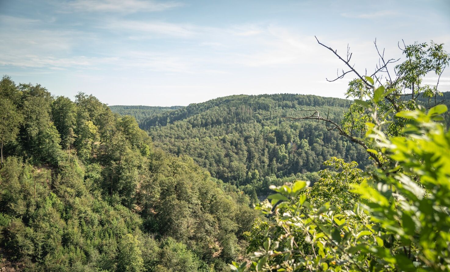
When we reach the top of the forest road, we turn left and hike steadily east until we reach the asphalt road in front of the Fürstenhöhe. There we keep left again. At about the height of the edge of the forest on the left side, on clear days a far-reaching view opens up to us on the right as far as the Swiss Alps, the so-called Säntisblick. A few meters further we come to the crossroads at the Fürstenhöhe parking lot and thus back to our starting point. At the wooden hut there is a barbecue area off to the side with many seating options, which invites you to take a final rest.
Please remember to wear sturdy shoes, weather appropriate clothing and walking sticks if necessary!
Please note that these are natural paths, which can be slippery, possibly icy, in appropriate weather conditions. Due to this, a complete walk on the trail in winter is not recommended for safety reasons!
Navigation to parking lot Fürstenhöhe:
Fürstenhöhe 4, 72488 Sigmaringen
ALTERNATIVE STARTING POINTS:
Parking lot Unterm Weckenstein:coming from Storzingen follow Weckenstein Straße, coming from Oberschmeinen follow Storzinger Straße
Parking lot Kiesgrube, Storzingen:
Schmeientalstraße 13, 72510 Stetten a. k. M. - Storzingen
Storzingen train station:
Bahnhofstraße 8, 72510 Stetten a. k. M.- Storzingen
Regular train service between Sigmaringen and Storzingen. Storzingen can be chosen as an alternative entry point to the tour. There are two access options to the premium trail: a flatter, approx. 1.5 km long variant via the Wolfergert parking lot or via an approx. 0.7 km short, but crisp climb.
You can find more information about public transport here.
Parking lot Fürstenhöhe, alternatively parking lot Schmeietal, parking lot Wolfergert and parking lot at the train station Storzingen
There are barbecue areas at the Unterm Weckenstein and Fürstenhöhe parking lots!
The "Swabian Dialect Trail" runs along a large part of the hiking trail. This entertaining theme trail offers Swabian poems from different regions with their characteristic dialects.
Beliebte Touren in der Nähe
- 4,8
Kloster Beuron
mittelWanderung 15,0 km - 5,0
Amalienfels Tour
leichtWanderung 14,6 km - 4,7
Donauradweg Etappe 2
mittelRadfahren 62 km - 5,0
Vom Finstertal zum Korbfelsen und Schloss Werenwag
mittelWanderung 9,85 km - 1,0
Thiergarten
leichtWanderung 6,13 km Donautal
leichtWanderung 3 kmZum Mammutbaum
leichtWanderung 7,12 kmAlter Hau Loipen in Meßstetten. Nacht- und Trainingsloipe Gletscher
mittelLanglaufen 1,99 kmDonaufelsenläufe - Klosterfelsenweg
mittelWanderung 12,7 km- 4,0
Donaufelsenläufe - Donaufelsengarten
leichtWanderung 8,64 km

Wandern & Tracking


Verpasse keine Angebote und Inspirationen für deinen nächsten Urlaub
Deine E-Mail-Adresse wurde in den Verteiler eingetragen.