Snowshoeing itinerary: Le chemin du Petit Bonheur
schwer
Navigieren
Navigieren
Hol diese Tour auf dein Handy
Snowshoeing itinerary: Le chemin du Petit Bonheur
schwer
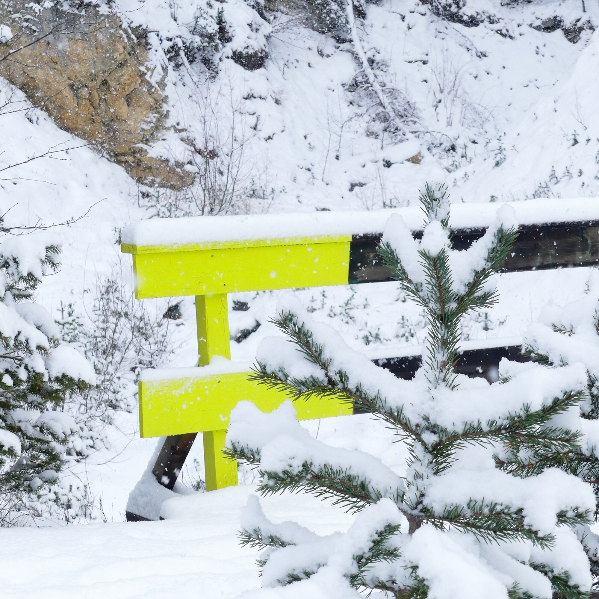
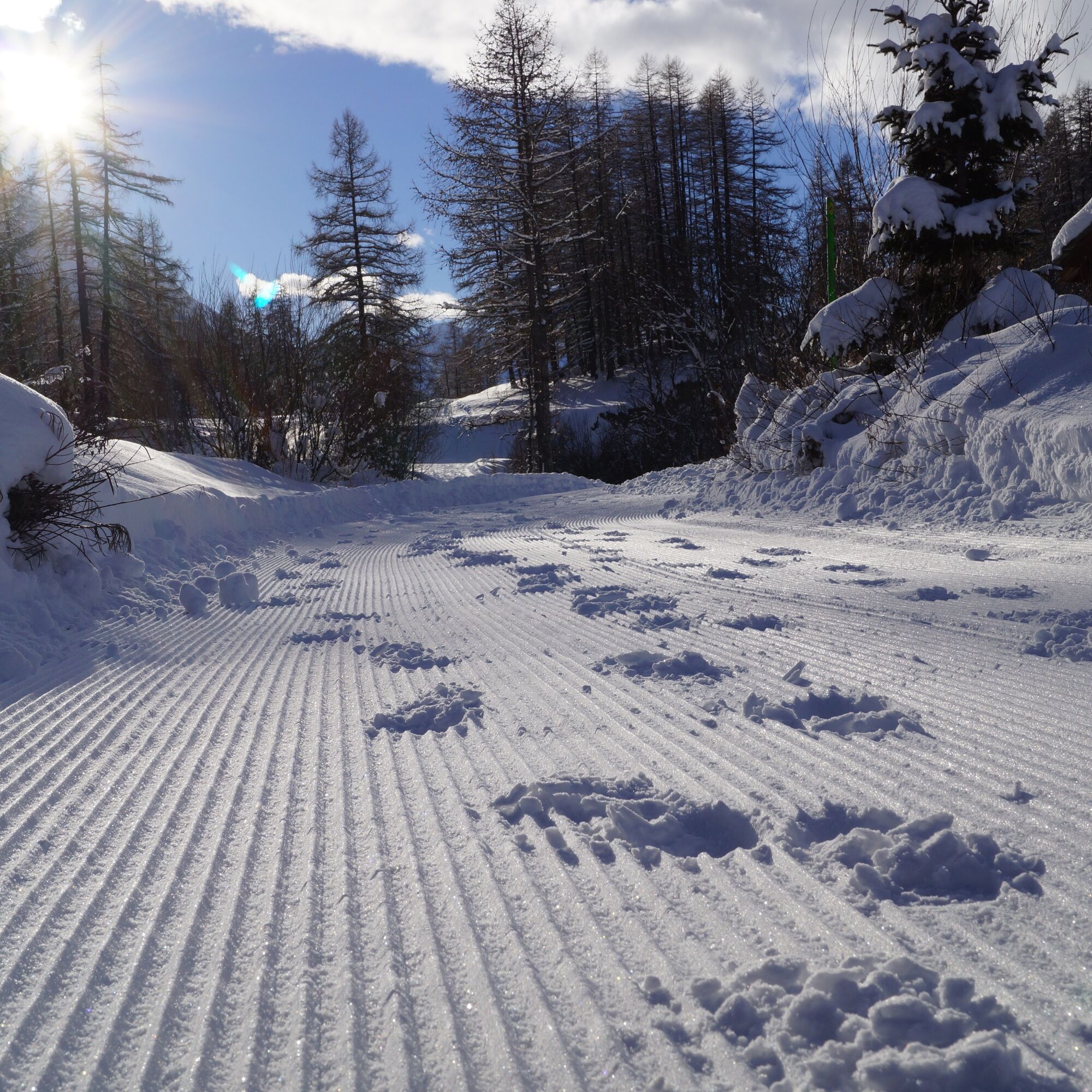
Schneeschuh
49,56
km
QR-Code scannen und Navigation in der bergfex App beginnen

Wandern & Tracking


Snowshoeing itinerary: Le chemin du Petit Bonheur
schwer
Distanz
49,56
km
Dauer
17:23
h
Aufstieg
1.431
hm
Seehöhe
1.093 -
2.027
m
Track-Download
Snowshoeing itinerary: Le chemin du Petit Bonheur
schwer
Schneeschuh
49,56
km
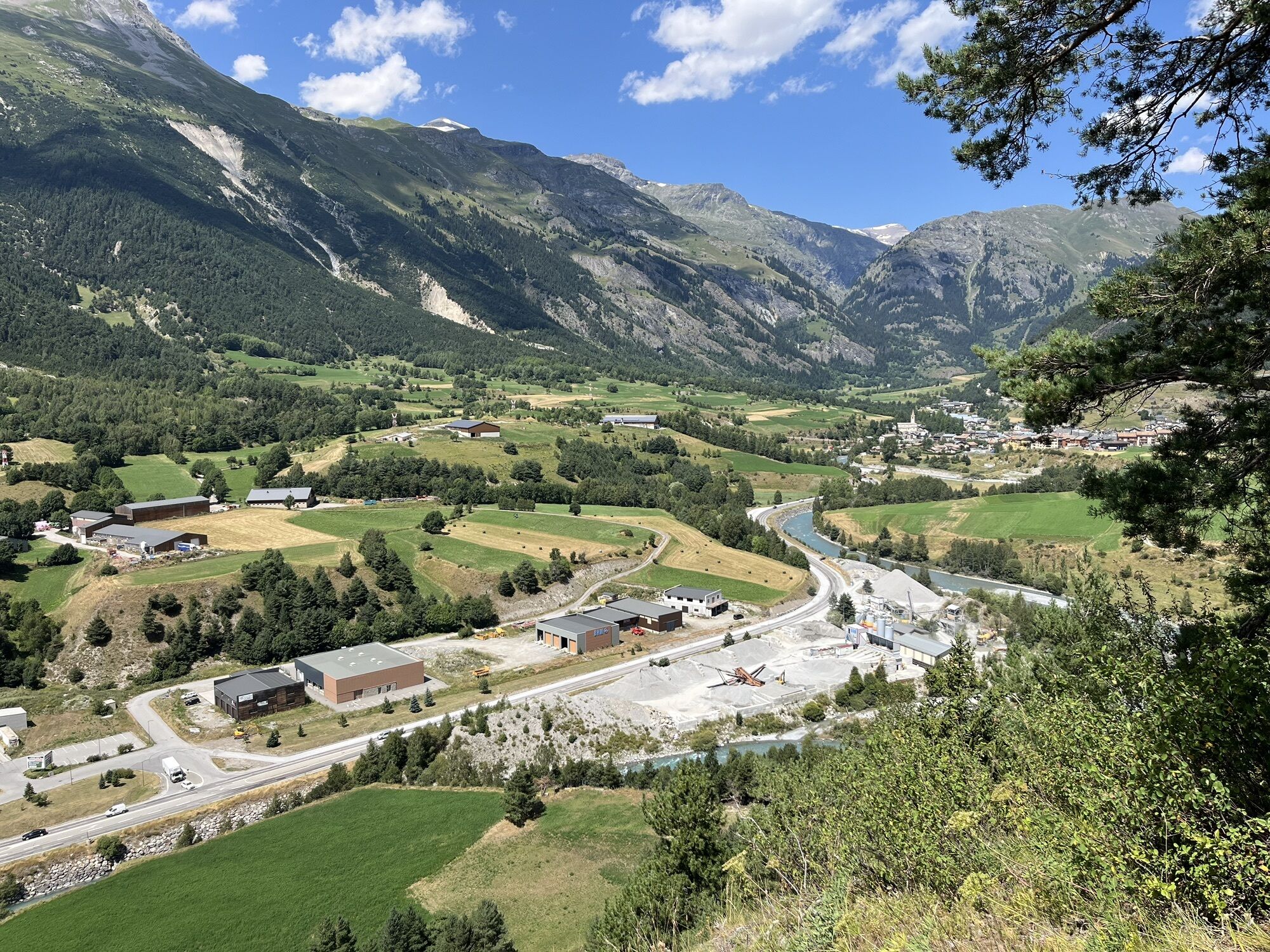
For almost 50 kilometers, between Modane (1,094m) and the hamlet of l'Écot (2,030m), the Chemin du Petit Bonheur is a promise to discover the cultural and natural riches of Haute Maurienne Vanoise. On...
Beschreibung
For almost 50 kilometers, between Modane (1,094m) and the hamlet of l'Écot (2,030m), the Chemin du Petit Bonheur is a promise to discover the cultural and natural riches of Haute Maurienne Vanoise. On foot, snowshoes or crampons, everyone can invent their own adventure: a break above a village, a few hours to get away from it all, or several days to enjoy the passing of time.
At every turn, huts, swings, giant tables, "petits pas" and other surprises await you: so many stops to dream, listen, smell... and rediscover, along the way, the simple and precious fragrance of small pleasures.
At every turn, huts, swings, giant tables, "petits pas" and other surprises await you: so many stops to dream, listen, smell... and rediscover, along the way, the simple and precious fragrance of small pleasures.
Wegverlauf
Église Notre-Dame-de-l'Assomption
(1.074 m)
Andachtsstätte
0,0 km
Grotte des 14 Chapeaux
(1.285 m)
Höhleneingang
10,3 km
Église Notre-Dame de l'Assomption
(1.236 m)
Andachtsstätte
12,1 km
Saint-Claude
(1.287 m)
Andachtsstätte
16,7 km
Église Saint-Michel
(1.483 m)
Andachtsstätte
27,8 km
Chapelle Saint-Étienne
(1.558 m)
Andachtsstätte
29,6 km
Chalet de Bonneval-sur-Arc
(1.815 m)
Schutzhütte
45,8 km
Wegverlauf
Snowshoeing itinerary: Le chemin du Petit Bonheur
schwer
Schneeschuh
49,56
km
Modane
(1.068 m)
Dorf
0,0 km
Église Notre-Dame-de-l'Assomption
(1.074 m)
Andachtsstätte
0,0 km
La Boucle
(1.093 m)
Stadtviertel
0,5 km
Avenières
(1.352 m)
Gondelstation
3,1 km
La Norma
(1.358 m)
Dorf
3,4 km
Les Marmotières
(1.372 m)
Siedlung
3,7 km
Les Oursières
(1.389 m)
Siedlung
4,0 km
Chalets du Petit Bonheur
(1.381 m)
Siedlung
4,1 km
Grotte des 14 Chapeaux
(1.285 m)
Höhleneingang
10,3 km
Mollard chez Nous
(1.312 m)
Flur/Gelände
10,7 km
Le Mollard
(1.260 m)
Siedlung
11,3 km
Bramans
(1.251 m)
Dorf
11,3 km
Les Glaciers
(1.250 m)
Restaurant
11,4 km
Les Grands Prés
(1.238 m)
Siedlung
11,5 km
Le Bossate
(1.250 m)
Siedlung
11,5 km
Les Moulins
(1.237 m)
Siedlung
11,8 km
L'Église
(1.236 m)
Flur/Gelände
12,1 km
Église Notre-Dame de l'Assomption
(1.236 m)
Andachtsstätte
12,1 km
L'Ilaz
(1.220 m)
Flur/Gelände
12,5 km
Le Verney
(1.222 m)
Dorf
12,8 km
Le Grand Courbet
(1.247 m)
Siedlung
13,2 km
Lenfrey
(1.233 m)
Siedlung
13,2 km
Plan de Serenaz
(1.249 m)
Siedlung
13,3 km
Saint-Claude
(1.287 m)
Andachtsstätte
16,7 km
Sollières L'Envers
(1.290 m)
Siedlung
16,9 km
Sollières-Sardières
(1.299 m)
Dorf
17,3 km
Termignon
(1.296 m)
Dorf
19,3 km
Val-Cenis
(1.296 m)
Dorf
19,3 km
Lanslebourg-Mont-Cenis
(1.390 m)
Dorf
24,8 km
Madeleine
(1.397 m)
Gondelstation
24,9 km
Madeleine
(1.405 m)
Gondelstation
25,1 km
Pont des Chèvres
(1.400 m)
Gondelstation
25,4 km
Herbefin
(1.431 m)
Siedlung
26,5 km
Les Champs
(1.432 m)
Siedlung
26,9 km
Chapelle Saint-Sébastien
(1.491 m)
Andachtsstätte
27,6 km
Église Saint-Michel
(1.483 m)
Andachtsstätte
27,8 km
L'Envers
(1.490 m)
Siedlung
27,8 km
Lanslevillard
(1.483 m)
Dorf
27,9 km
Chapelle Saint-Étienne
(1.558 m)
Andachtsstätte
29,6 km
Chantelouve d'en Bas
(1.686 m)
Siedlung
30,9 km
Chantelouve d'en Haut
(1.770 m)
Siedlung
31,4 km
Bessans
(1.710 m)
Dorf
36,7 km
La Grange du Traverole
(1.741 m)
Restaurant
40,3 km
Rocher du Château
(1.775 m)
Flur/Gelände
42,0 km
Église Notre-Dame-de-l'Assomption
(1.787 m)
Andachtsstätte
45,2 km
Bonneval-sur-Arc
(1.789 m)
Dorf
45,3 km
Chalet de Bonneval-sur-Arc
(1.815 m)
Schutzhütte
45,8 km
Pré Catin
(1.824 m)
Siedlung
45,9 km
Tralenta
(1.836 m)
Siedlung
46,0 km
Cascade des Échos
(2.003 m)
Wasserfall
48,2 km
L'Écot
(2.029 m)
Siedlung
49,3 km
Autor
Bereitgestellt von Haute Maurienne Vanoise
Die Tour Snowshoeing itinerary: Le chemin du Petit Bonheur wird von outdooractive.com bereitgestellt.

Weginformationen
Einwegtour
Ja
Zusatzinfos & Tipps
Zusatzinfos
As hazards may occur at any time on the routes, the GPX tracks provided are not contractual. They are provided for information only. Riders use them at their own risk, depending on their level of technological proficiency and their understanding of the terrain.
Noch keine Bewertungen
Beliebte Touren in der Nähe
Petite Haute Mauriennaise
schwerRennrad 32,0 kmRefuge du Fond d'Aussois - ein wildes Tal in der Vanoise - 2-Tages-Wanderung
leichtWanderung 9,22 kmDer Lac Blanc
leichtWanderung 4,42 km- 5,0
Le sentier des Bâtisseurs
leichtThemenweg 7,23 km Randonnée pédestre du refuge d'Avérole par le hameau
mittelWanderung 9,36 kmRadanstieg zum Col du Mont-Cenis ab Lanslebourg
schwerRennrad 9,84 km- 5,0
Goldtoni - Alpenbogen A068 Refuge de la Leisse-Termignon Val Cenis
mittelFernwanderweg 28,7 km Col de l'Iseran from Modane
schwerRennrad 59,5 kmCol du Mont-Cenis von Modane aus
schwerRennrad 34,8 km- 5,0
Spaziergang zur Hütte Plan du Lac
leichtWanderung 4,58 km

Wandern & Tracking

Über 550.000 Tourenvorschläge, detailliertes Kartenmaterial und ein intuitiver Routenplaner machen die App zum Must-have für alle Naturbegeisterten.

Verpasse keine Angebote und Inspirationen für deinen nächsten Urlaub
Zum Newsletter anmelden
Fehler
Ein Fehler ist aufgetreten. Bitte versuche es erneut.Vielen Dank für deine Anmeldung
Deine E-Mail-Adresse wurde in den Verteiler eingetragen.
Touren in ganz Europa
Österreich Schweiz Deutschland Italien Slowenien Frankreich Niederlande Belgien Polen Liechtenstein Tschechien Slowakei Spanien Kroatien Bosnien und Herzegowina Luxemburg Andorra Portugal Island Vereinigtes Königreich Irland Griechenland Albanien Nordmazedonien Malta Norwegen Montenegro Moldau Kosovo Ungarn San Marino Rumänien Estland Lettland Belarus Zypern Litauen Serbien Bulgarien Monaco Dänemark Schweden Finnland