


Trail hauts des forts (version longue)


Departure from the bay of Collioure, beautiful ascension in the scrubland to go around the forts above Collioure. The end of the route is via the coastal path.
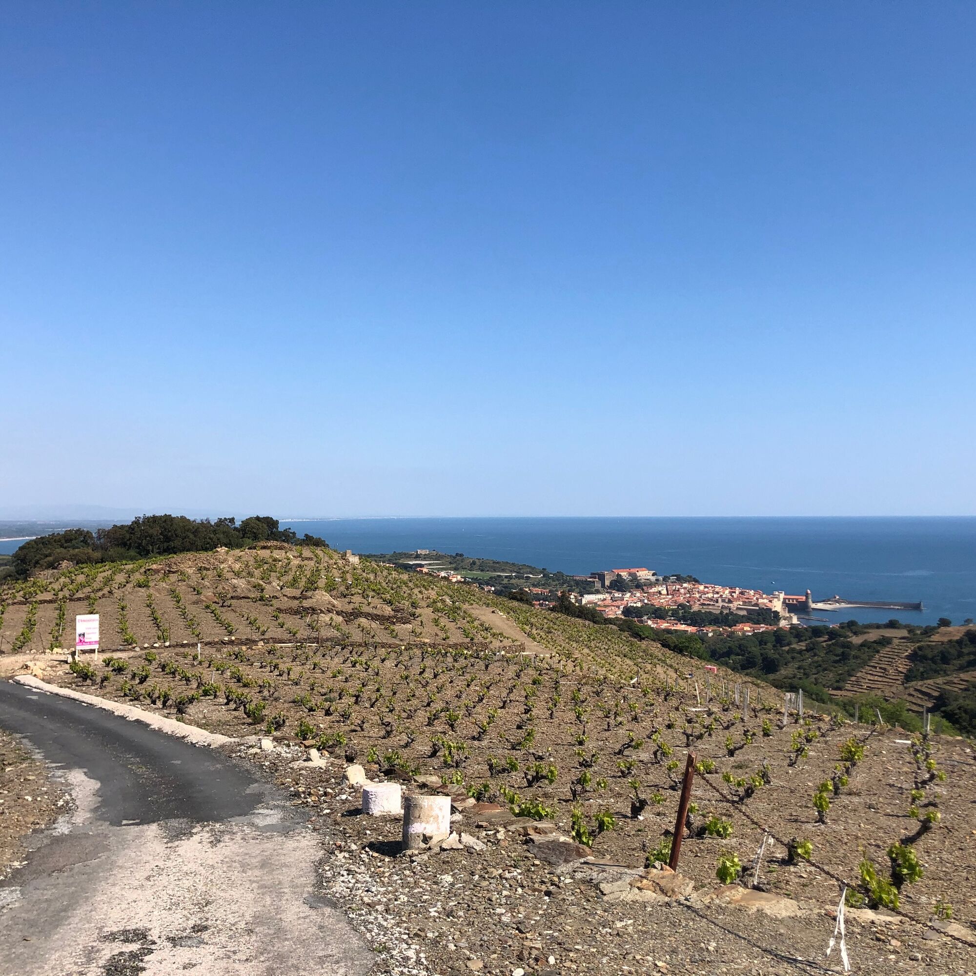
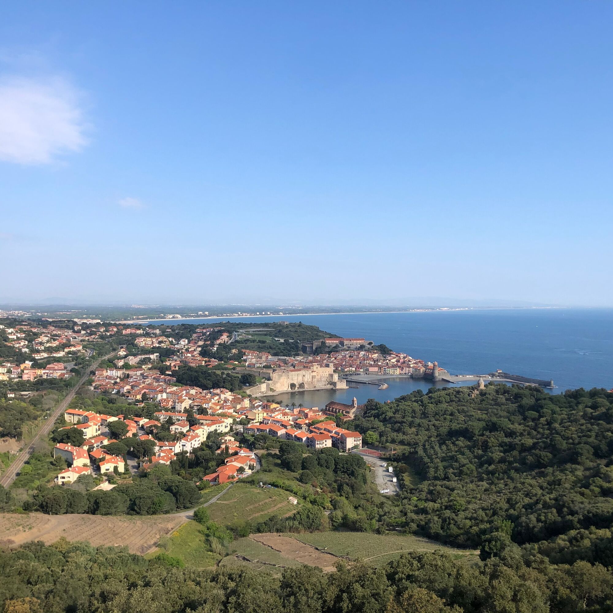
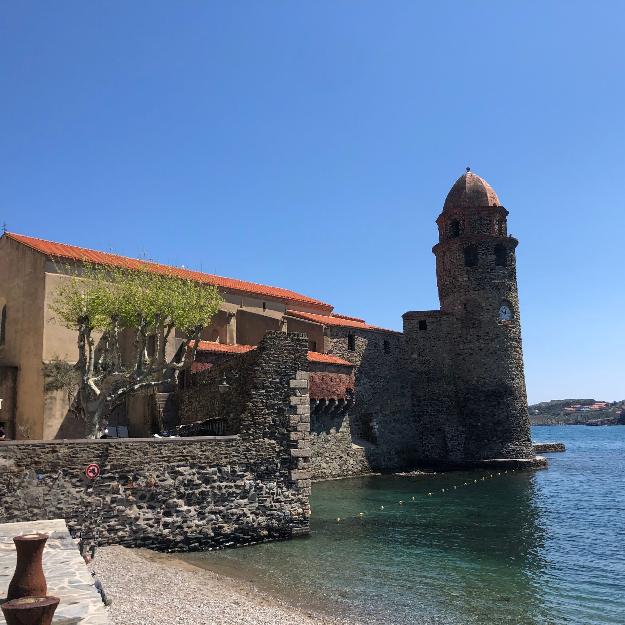
Start from the beach St-Vincent to the royal castle, follow the sea along the beach and typical neighborhood “le faubourg”. Go up to the Collioure Museum of Modern art in the direction of the Cortina mill.
Turn left before climbing the stairs surrounded by olive trees that lead to the Cortina mill. Arrival at the glorieta, magnificent view of the bay of Collioure. Take to the right of the glorieta, in the direction of the Cortina mill.
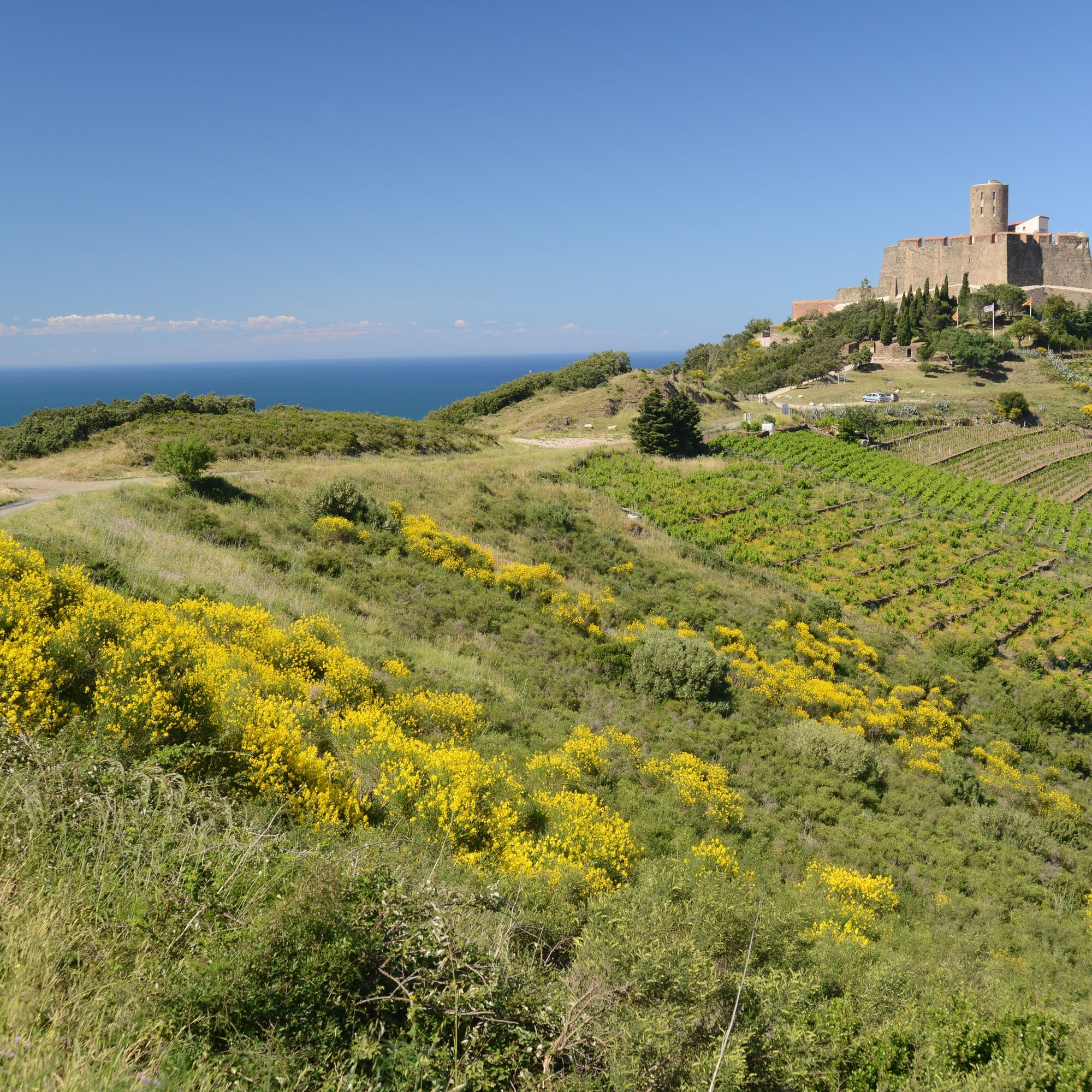
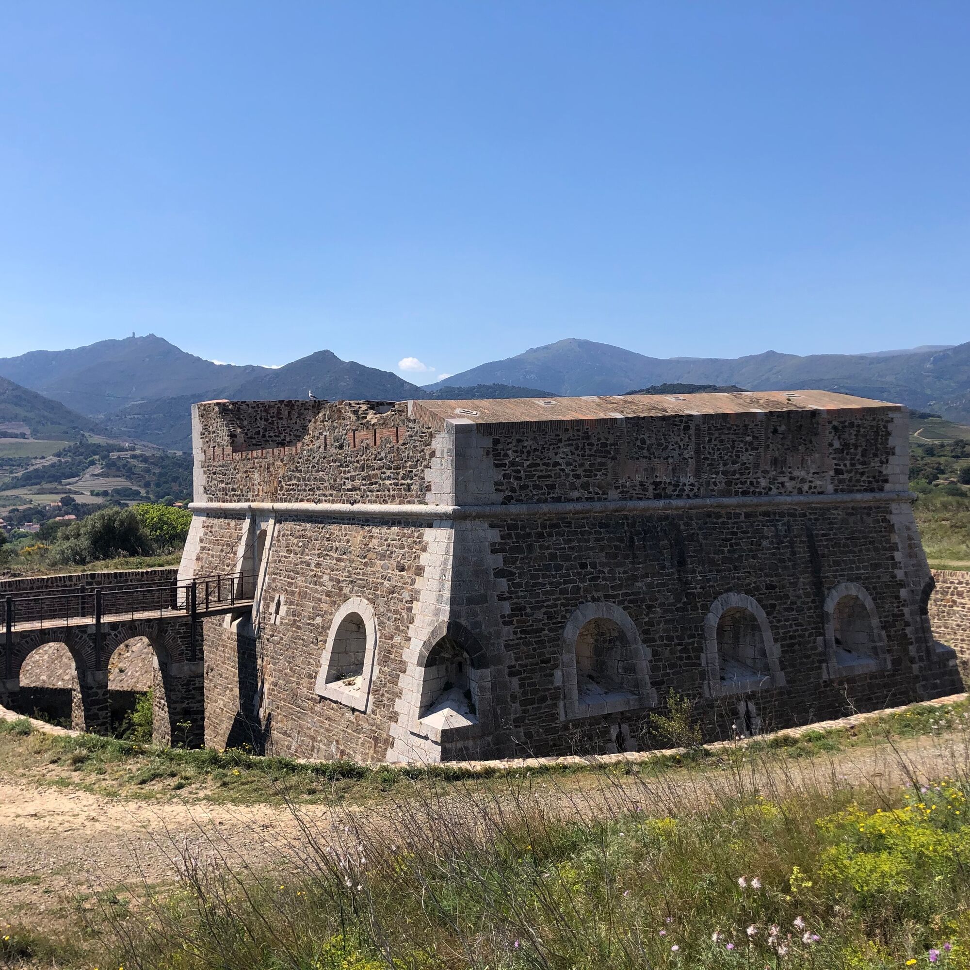
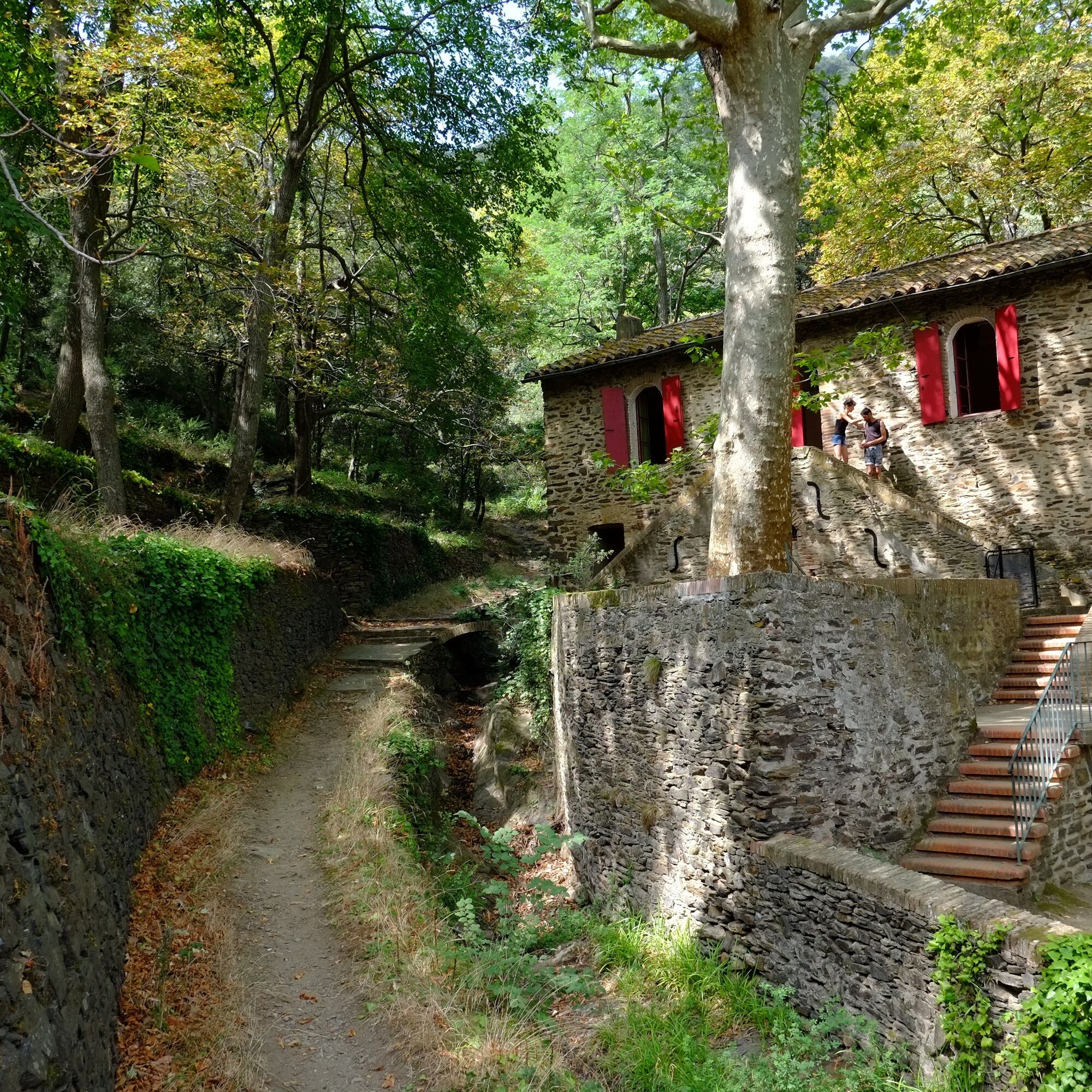
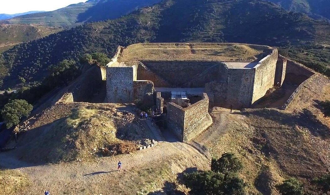
Arrival at the mill, climb the path that leads to fort St-Elme that rises in front of you. Continue on this path that passes under the fort, until the first crossing, go straight. At the second crossing turn left, climb the asphalt road that runs along the forts. Take this old road, which goes to the left of fort Dugommier.
Arrival at the Col d’en Raixat (218 yards), take the path on your left. magnificent view from the other side of the Collioure’s forts. Follow this path around the Puig de les Daines (364 yards). Magnificent panorama over Port-Vendres, Banyuls sur mer far away, the fort Béar and the Madeloc tower. At the first crossing take the rising path on the right, then go down to the col Mollo (252 yards) by the very steep dirt trail in the middle of the vegetation at the next change of direction (dangerous descent).
Arrival at the col Mollo (252 yards) take the earth path that rises before you in the junction of the two roads. Follow this trail on the crest of the mountain that offers a magnificent view of the Vermeille coast. Once at the summit, turn left, Taillefer’s battery is above you.
Take the second path on the right which goes up on the crest of the mountain, magnificent view on the Vermeille coast on the left, and the Ravaner valley on the right.
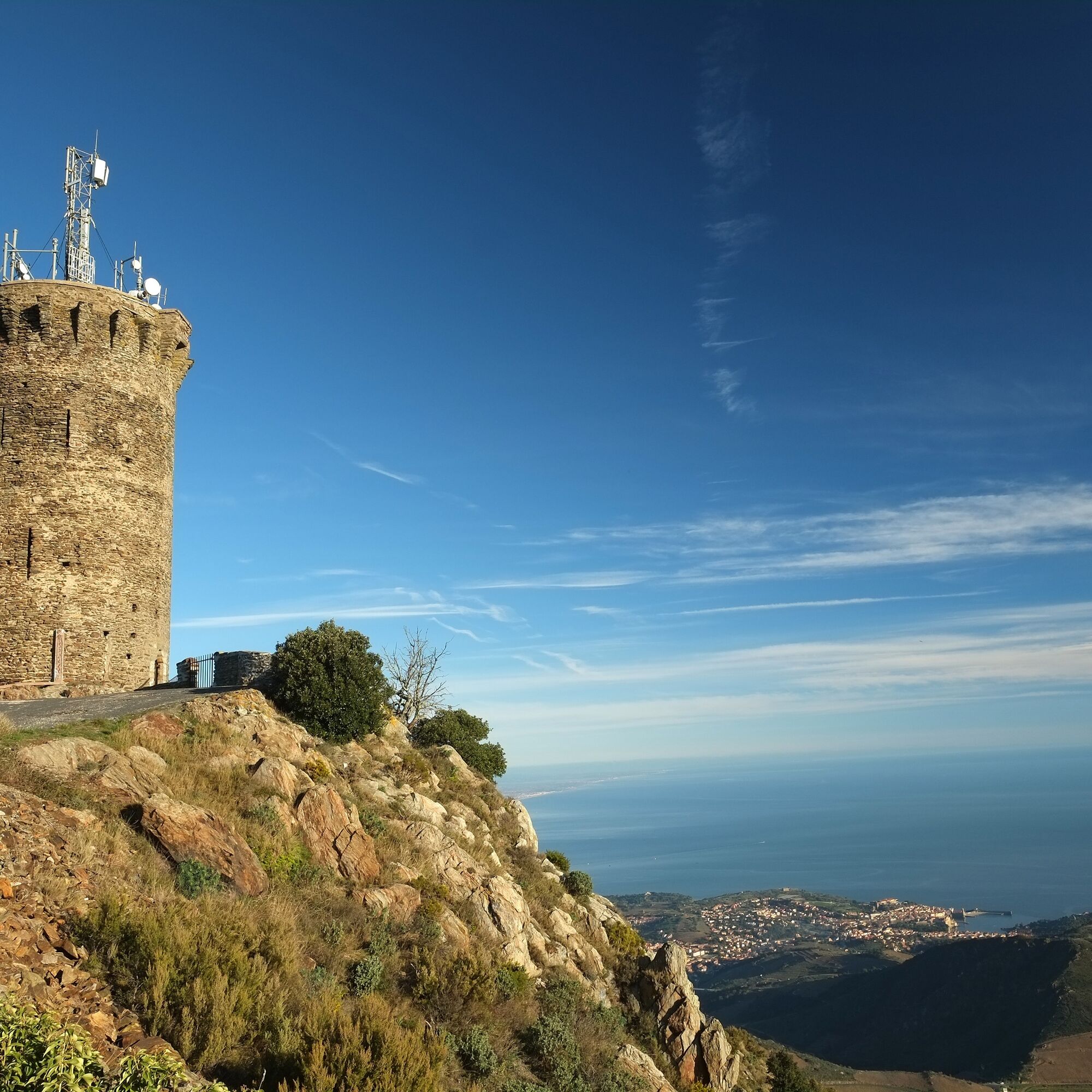
Follow the path that rises to reach the peak of the mountain until reaching the summit and the Madeloc tower (713 yards). You’re here at the highest point of the track. Here you have a 360° view of the Vermeille coast, the Ravaner valley, the Pyrenees and Spain can be seen in the background.
Go down the old asphalt access road in front of you until you reach the stone building in a turn. Take the path on the left of this edifice that joins the Coll Gascons (422 yards).
Take the road on your left to join the Coll Vallauria (459 yards). Once reached, take the second path on your right that descends into the valley (be careful of your choice). Follow this path on the side of the mountain. At the crossing to go up to the Coll Tallaferro (508 yards), continue straight to go around the Taillefer’s battery until you reach the Col Serra (371 yards).
Once reached the Col Serra (371 yards), take on your right the asphalt road for 300 yards to reach a big rock at the edge of the road, take the path behind this rock to reach Consolation.
Go down to consolation through the forest, follow the path (difficult passage). Arrived at Consolation take on the right the road that goes down to the bottom of the cliff. Follow the river “le dui” towards Collioure with the asphalt trail that follows the river.
Arrive in the city center. Take the direction of the stadium by the asphalt road that rises, follow the stadium and then take on your right. Arrival on the fort Carré trail. Follow the trail to the fort. Continue on the path on the other side that leads to the fort Rond.
Go down to the road, take on your right to reach the old road that goes down to the beach. Follow this one to reach the old road that goes down to the beach. Follow this one to reach the “plage de l’Ouille”.
Arrived at “plage de l’Ouille” take the stairs that stands in the cliff on your right (difficult crossing). Arrive on the coastal path that runs along the sea. Advance to Collioure while seeing Fort Miradou. Take the path on your right to return to the road.
Take the road along the stadium to go down to the town of Collioure. Turn left at the first roundabout and follow Fort Miradou to reach the old Collioure’s streets.
go down to the church of Notre Dame des Anges and its bell tower through the narrow streets. Once you have reached Saint-Vincent beach, return to the royal castle.
Ja
D914
Busses 1€
Glacis car park
Remember to hydrate. Do not stray from marked trails. Do not throw anything in nature.
Beliebte Touren in der Nähe
[Connection] Elne-Argelès-sur-Mer
mittelRennrad12,3 kmRallye-enquête : Le linteau millénaire de Saint-Genis-des-Fontaines
mittelRennrad28,6 kmMadeloc
mittelWanderung8,83 kmGR10 Pyrenäenweg Etappe 55
mittelFernwanderweg23,2 kmAuf den Anhöhen von Cosprons
leichtMountainbike6,77 kmCatalan Getaway in the Pyrenees Mediterranean
mittelRennrad62,4 kmLa Retirada und die Wege des Exils
mittelWanderung5,26 kmVon Lavail nach Valmy über den Tour de la Massane
mittelWanderung10,3 kmOrientierungs-Route in Laroque-des-Albères
leichtTrailrunning3,71 kmEurovélo 8 (2020) : Teilstrecke von Argelès-sur-Mer nach Sorède
mittelRennrad16,3 km
Wandern & Tracking


Verpasse keine Angebote und Inspirationen für deinen nächsten Urlaub
Deine E-Mail-Adresse wurde in den Verteiler eingetragen.