


Catalan Getaway in the Pyrenees Mediterranean


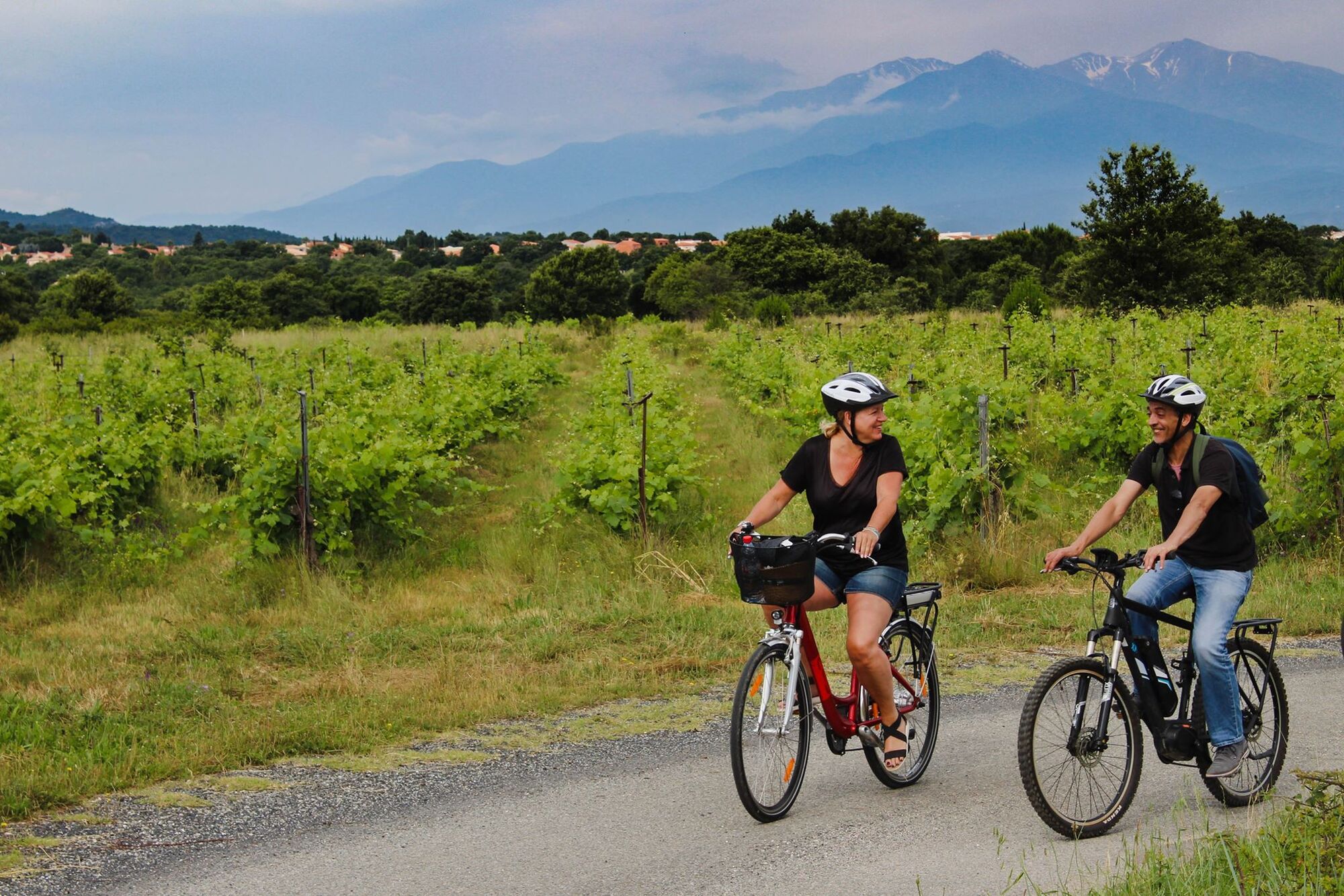
Taking this route means exploring the landscapes of the region and setting out to discover its flavors, heritage treasures, and local craftsmanship. The journey winds through fields of crops (vineyards,...
Taking this route means exploring the landscapes of the region and setting out to discover its flavors, heritage treasures, and local craftsmanship. The journey winds through fields of crops (vineyards, olive trees, other trees), and the deep blue sea is also part of the adventure!

Departure from the Tourist Office of Elne: After a detour into the historic center, go down Rue du Couvent to the right of the Tourist Office.
Turn right onto Avenue du Général de Gaulle. Continue straight after the roundabout.
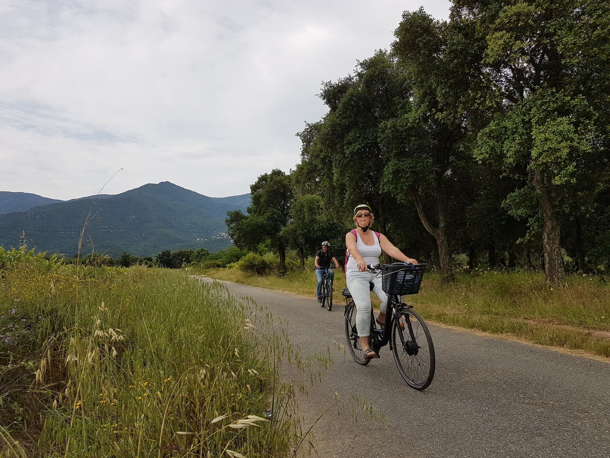
Turn left after the railway tracks onto the D40, which you will follow to Ortaffa. The civil bell tower, shaped like the Eiffel Tower, will surely catch your attention.
Continue on the D40, Avenue du Carignan,
and then Avenue du Vallespir. At the roundabout after the level crossing, head towards Brouilla. Cross the village.
Head towards Saint-Genis-des-Fontaines. Domaine Bisconte is signposted on this road to the left before reaching Saint-Genis.
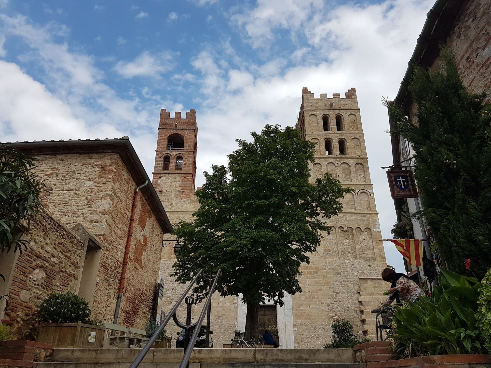
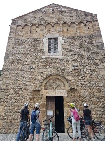
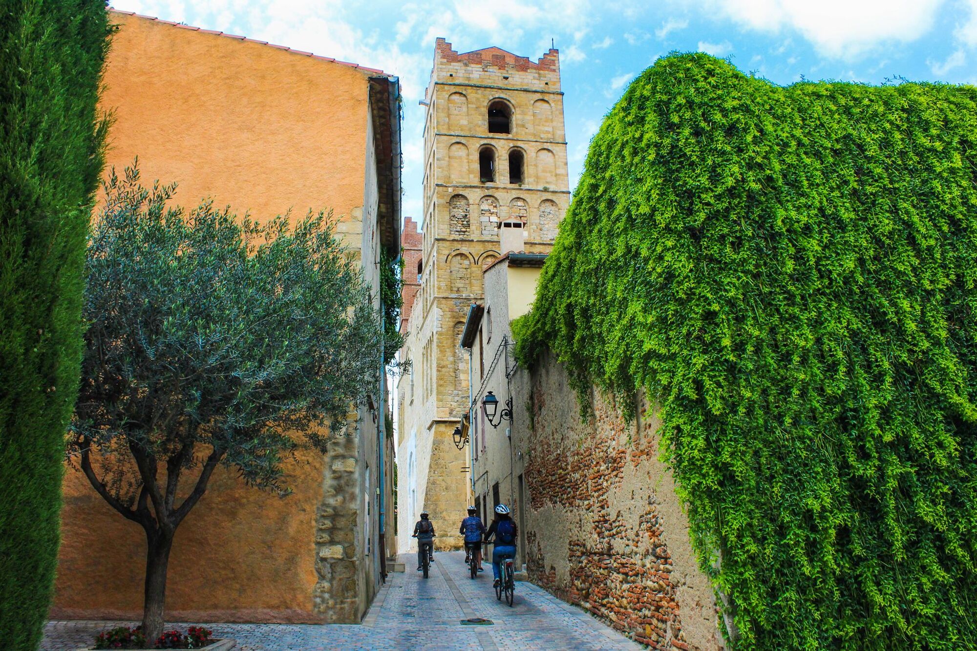
Upon arrival in Saint-Genis : Turn left onto Rue Maréchal Joffre, then right onto Rue Clemenceau.
Take a break to admire the famous lintel and visit the Romanesque cloister and Saint-Michel church.
Turn left onto Avenue des Albères and go straight, passing two roundabouts.
Continue along the small road through the fields.
Turn right towards Laroque-des-Albères
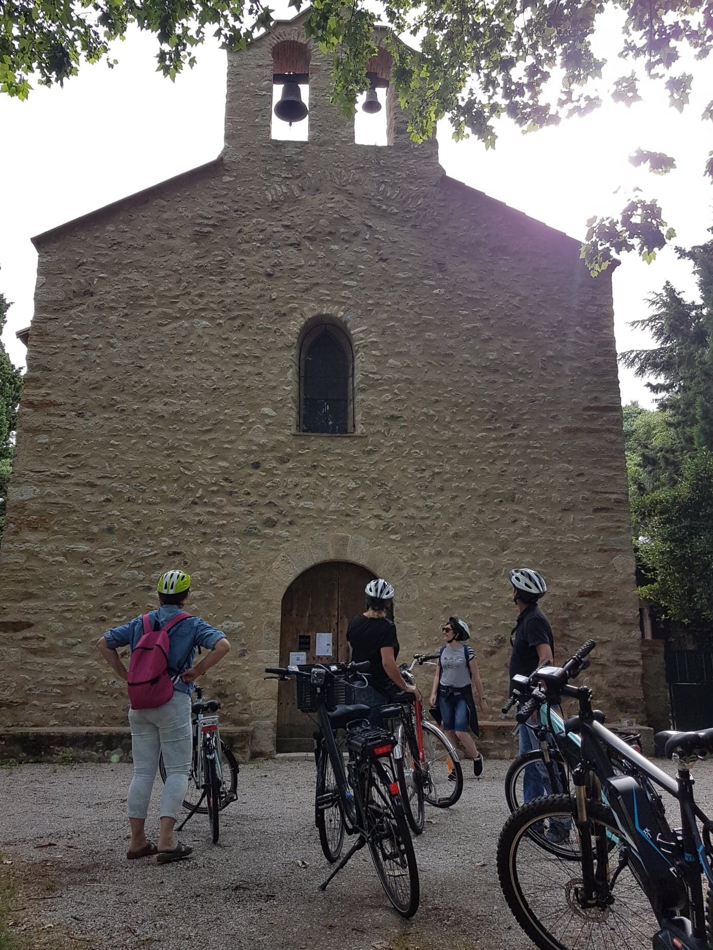
A stop at the Tanya Chapel is recommended.
Then head to the center of Laroque, a charming village where many restaurants await.
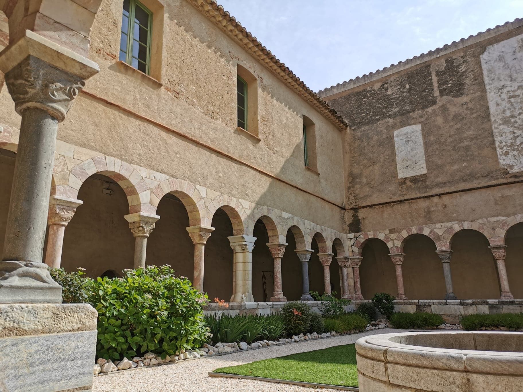
Leaving Laroque : Cross the bridge and turn left onto Avenue du Vallespir. Stay on this road to Villelongue-dels-Monts to visit the Santa Maria del Vilar priory nestled in the mountains.
Take a left onto Cami del Vilar and follow the yellow markers to the priory.
Return the same way and head back to Laroque-des-Albères to explore local producers. Stop at Domaine "Le Temps Retrouvé" on Avenue du Vallespir.
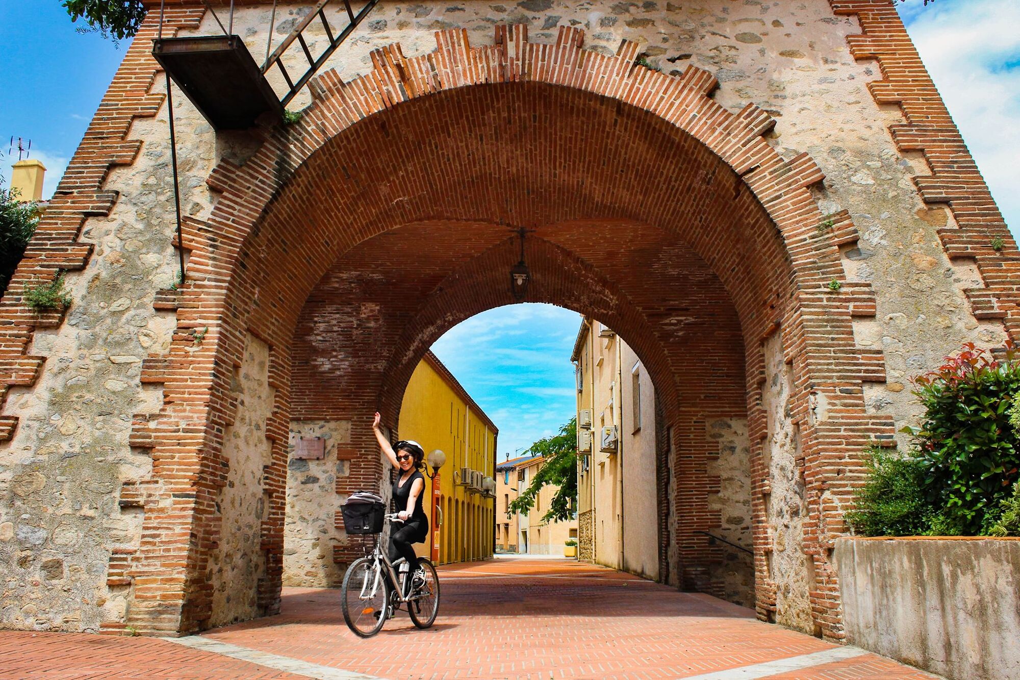
In Laroque:Turn right onto Rue de Roca Vella (a very steep street).
Turn right and go straight on Avenue des Mas Catalans to discover "La Maison de l'Amande" 300m further. Then return to the center of Laroque and climb up to the tower, passing by the church.
Head towards Sorède, stopping at an olive oil producer.
Turn left onto Avenue des Baléares. "Le Moulin du Llevant" will be on your right. To reach Sorède, go down Avenue des Baléares to a junction.
Turn right, cross the ford, and continue straight to Sorède on this small road offering magnificent views of the Albères.
Turn right onto Rue de la Gabarre, then left towards the Tourist Office.
Behind the Tourist Office:Visit the wooden whip factory made from hackberry wood, a tradition dating back to the 13th century. You can also take a detour through the heart of the village.
Back on Rue de la Gabarre
Turn right onto the EuroVelo 8.
Turn left, then take the next right.
On the Route de Palau, go up to the right, then take the first left.
Go left, then right onto Chemin de Saint-André, followed by Rue Joan Cayrol.
Turn left, then at the roundabout, take Rue des Albères to the crossroads.
Go straight on Rue du Moulin towards the church and the "Maison de l'art roman."
At the end of Rue de la Liberté : Turn right, then left onto Rue de Taxo. Continue on this road, which leads to the Pirenexus.
Turn left, and at the roundabout, take the D11 to the right to reach the village of Palau-del-Vidre (Glass Palace) to visit the glassmakers' workshops.
To do this:Turn right onto Rue Joliot Curie towards the village center.
The Sant Marti de Palau lake is perfect for a picnic break. From there, go left onto Rue de la Tramontane, then Chemin de Perpignan.
To head towards Argelès : Return to the Pirenexus.
At the roundabout, go straight on the paved road that passes an aeromodelling club and follows the railway (a slight incline). It leads to Argelès at a roundabout.
In Argelès : Go straight on Avenue de Mongat (Union Pharmacy), then turn right and pass behind the bank, following the Pirenexus markers along Rue des Colibris, then Rue des Merles. Cross the river "La Massane," and turn left to follow its path.
Turn left onto Rue du 14 Juillet until the roundabout, where you'll take Rue des Trabucayres ahead.
At the next roundabout : Turn right, pass the tennis courts and the multipurpose hall.
At the stadium roundabout, turn left onto Route de la Mer. Near the gas station, continue straight on Avenue du Général de Gaulle. At the arrival roundabout, turn left onto Avenue des Platanes. Before the Tourist Office, turn right onto Avenue des Pins. Continue straight to the green promenade on the left.
After crossing the pine wood :Turn left (the next path after the Monolith of Spanish Exiles), between two buildings, and continue on Avenue de la Méditerranée. Turn right onto the dirt path that connects to the bike path along the coastal road, passing by campsites.
At the Tech bridge, turn left.Make a small detour to the beautiful beach of the Mas Larrieu Nature Reserve (//!\ naturist and textile beach).
Return to the bridge and head towards Elne on Chemin de Sainte Eugénie, where you’ll see the pretty Sainte Eugénie de Tresmals chapel.
Turn right onto the small road, then left at the bridge to enter Elne via Cami de la Mar.
At the roundabout : Take Cours de l’Europe, then straight onto Rue d’Oran. Turn right onto Rue du Salita. Turn left onto Avenue Général de Gaulle and go up to Rue du Four à Chaux towards the Elne Tourist Office.
D914, D612
Bus à 1€
Parking de l'Office de Tourisme
Ensure proper hydration. Make sure to follow the traffic regulations.
Beliebte Touren in der Nähe
Trail hauts des forts (version longue)
mittelTrailrunning21,8 km[Connection] Elne-Argelès-sur-Mer
mittelRennrad12,3 kmRallye-enquête : Le linteau millénaire de Saint-Genis-des-Fontaines
mittelRennrad28,6 kmMadeloc
mittelWanderung8,83 kmGR10 Pyrenäenweg Etappe 55
mittelFernwanderweg23,2 kmAuf den Anhöhen von Cosprons
leichtMountainbike6,77 kmAnstrengend aber wunderschön. Nur etwas für MTB
mittelE-MTB24,7 kmVon Lavail nach Valmy über den Tour de la Massane
mittelWanderung10,3 kmOrientierungs-Route in Laroque-des-Albères
leichtTrailrunning3,71 kmEurovélo 8 (2020) : Teilstrecke von Argelès-sur-Mer nach Sorède
mittelRennrad16,3 km

Wandern & Tracking


Verpasse keine Angebote und Inspirationen für deinen nächsten Urlaub
Deine E-Mail-Adresse wurde in den Verteiler eingetragen.